

Aerial Intelligence. Geospatial Precision.
FAA part 107 Certified · Fully Insured · El Paso, TX · Veteran Owned.
Services
Commercial aerial mapping and inspection services for El Paso and West Texas.
Georeferenced 2D site maps and orthomosaics
Progression Images of site over time
Delivered in GeoTIFF, DWG, and PDF
Compatible with AutoCAD, Civil 3D, and ArcGIS
Centimeter-level accuracy with RTK

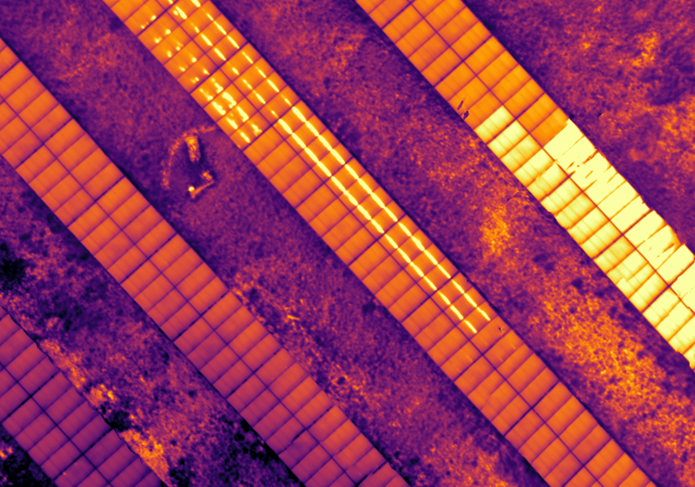
Hotspot and string anomaly detection
Identifies underperforming panels before they fail
Ground-mount and rooftop arrays
Maximizes energy output and protects your investment


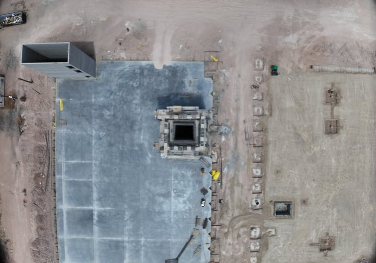
New Construction
Solar Panels
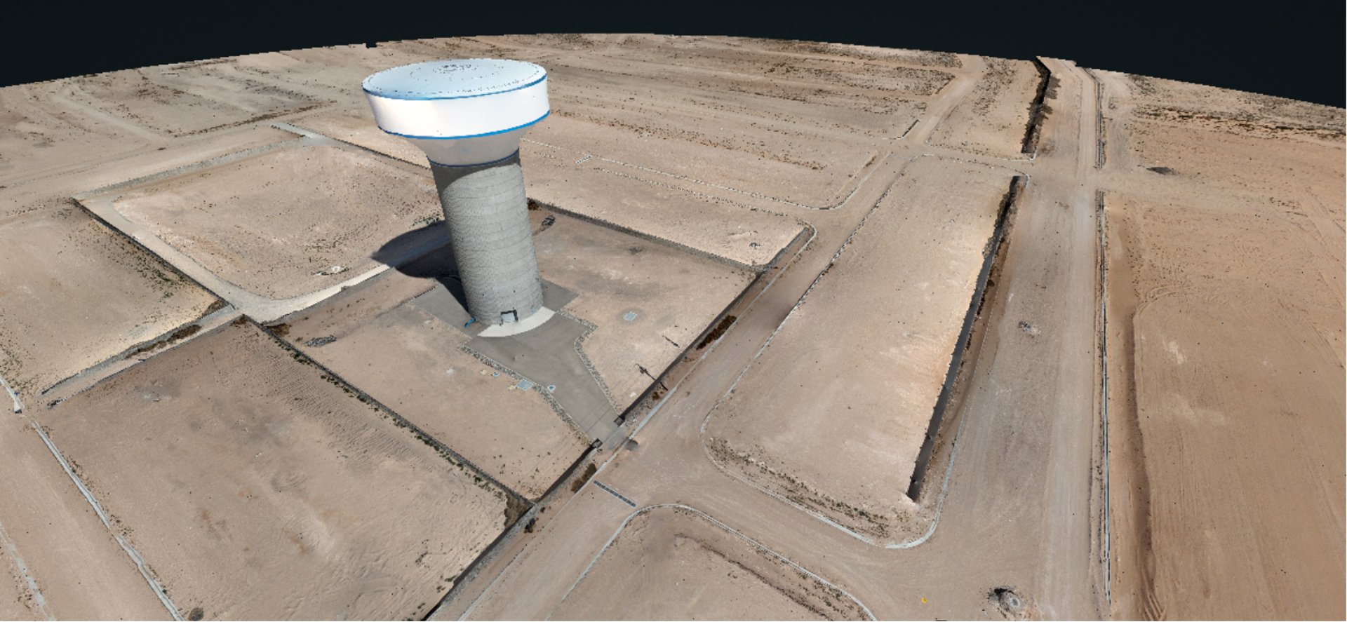
Towers
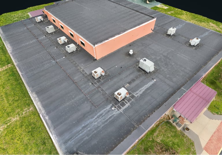
Thermal anomaly detection on energized equipment
Covers conduit runs, junction boxes, and disconnect panels
No interruption to operations required
Identifies failing components before they cause downtime

Photogrammetric 3D reconstruction of buildings and structures
Dense point clouds and textured mesh models
Accurate geometry for architecture and engineering
Exportable to AutoCAD, Revit, and ArcGIS
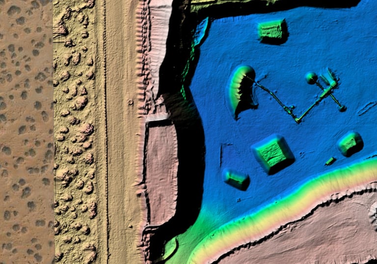
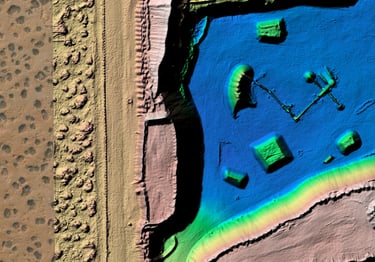
Digital Elevation Models (DEMs) and Digital Surface Models (DSMs)
Volumetric cut/fill analysis for earthwork verification
Drainage planning and grading support
Delivered for civil engineering and site development workflows
Full aerial condition documentation
Pre-acquisition due diligence support
Insurance renewal and claims documentation
Capital improvement planning and tenant dispute records


3D Capture (Digital Twin)
Elevation Analysis
Property Documentation
Built on 20 Years of Army Geospatial Intelligence Leadership
Fieldcraft Aerial Mapping was founded by Dustin Crowe, a U.S. Army Warrant Officer with 20 years of service, including 16 years as a 125D Geospatial Engineering Technician and senior Geospatial Intelligence (GEOINT) leader. That career was built on one principle — precise data drives better decisions.
He holds the NGA GEOINT Professional Certification, the DoD's standard for credentialed geospatial intelligence practitioners across the National System for Geospatial Intelligence.
Today, Fieldcraft delivers georeferenced aerial mapping, thermal inspection, construction progress documentation, and building condition assessments to commercial clients across El Paso and West Texas. Equipped with the DJI Matrice 4T thermal drone and DJI Matrice 4E mapping drone, every engagement is executed with the discipline and precision that 20 years of GEOINT demands.


Certified Geospatial Intelligence (GEOINT) Professional by the National Geospatial-Intelligence Agency
Veteran Owned - U.S. Army CW2 · 125D Geospatial Engineering Technician
FAA Part 107 Remote Pilot Certificate — Small Unmanned Aircraft Systems (sUAS)
Fully Insured
Request a Quote
Tell us about your project and we'll respond within one business day. COI available on request.